Excellence
Timeliness
Professional Surveyors & Mapping Services

Boundary Surveys
Whether purchasing, refinancing, or needing permits for construction, banks and municipalities require an updated Map of Boundary Survey. DJS performs Boundary Surveys for commercial and large-scale residential properties throughout Florida.

Topographic Surveys
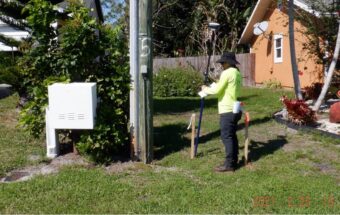
Topographic surveys show the elevations on existing improvements or natural ground within and around a project site. The information on the survey is needed for the design of new projects and the renovation of existing sites.
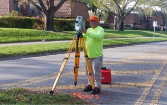
Right-of-Way Surveys
Right-of-Way Surveys show the existing improvements in relation to the right-of-way for the design of future roadways or for the improvements of existing roads. DJS also performs the field staking of right-of-way lines needed during construction.
ALTA/NSPS Surveys
These types of surveys are required by lenders for the purchase or refinance of commercial properties. The review of a provided title search and other possible lender requirements such as: zoning information, parking space count, building height, etc. are reflected on an ALTA/NSPS survey.

Drone UAV LiDAR Mapping
LiDAR (Light Detection and Ranging) is a laser based scanner system that utilizes light to capture high-resolution data to map the land. The data allows us to examine both natural and manmade environments with more precision.
Welcome to DJS Surveyors
Fast, efficient, and honest, DJS Surveyors, Inc. has become a reputable and well-known Surveyor in the state of Florida. Our team manages projects with the skill and experience our clients have come to expect. We want our customers to be satisfied with our work, which is why we provide open communication channels throughout the duration of each project.
Services
- ALTA/NSPS Surveys
- As-built Surveys
- Boundary Surveys
- Condominium Surveys
- Construction Surveys
- Drone UAV Mapping Surveys
- Laser Scanner Topographic Surveys
- Right-of-Way Surveys
- Route Surveys
- Specific Purpose Surveys
- Topographic Surveys
- Canal & Lake Soundings
- Construction Layout
- Platting
- Sketch & Legal Descriptions
- Title Commitment Review
Surveying Services
- ALTA/NSPS Surveys
- As-built Surveys
- Boundary Surveys
- Condominium Surveys
- Construction Surveys
- Drone UAV Mapping Surveys
- Laser Scanner Topographic Surveys
- Right-of-Way Surveys
- Route Surveys
- Specific Purpose Surveys
- Topographic Surveys
- Canal & Lake Soundings
- Construction Layout
- Platting
- Sketch & Legal Descriptions
- Title Commitment Review